Subscribe to our newsletter
Stay up to date on what's happening in the drone world. Our newsletter will regularly bring you
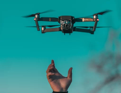
Drones in industry

Aerial imagery provides valuable high-resolution data. Check in confined spaces, we take informative photographs and obtain useful information.

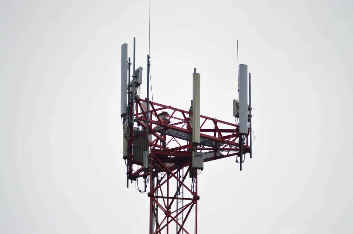
Determine the condition of the tower, existing installed equipment and other facilities. Using images taken by drone, we will capture all angles of the tower for you to decide.

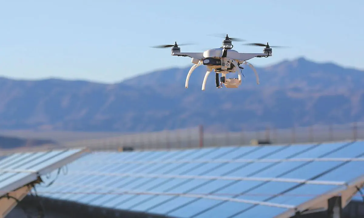
We will use drone photography to inspect installations of solar panels, wind turbines and power lines. We fly around large solar installations to check the condition of the panels or wind turbine and get details of their condition.

Visualization of the condition of the bridge, detection of weak structural points or demonstration of the construction of a newly completed bridge. Drones make it possible to collect valuable information and take attractive promotional images.

Use aerial imagery to get the information you need for your project. We will provide you with professional images to get the relevant information.
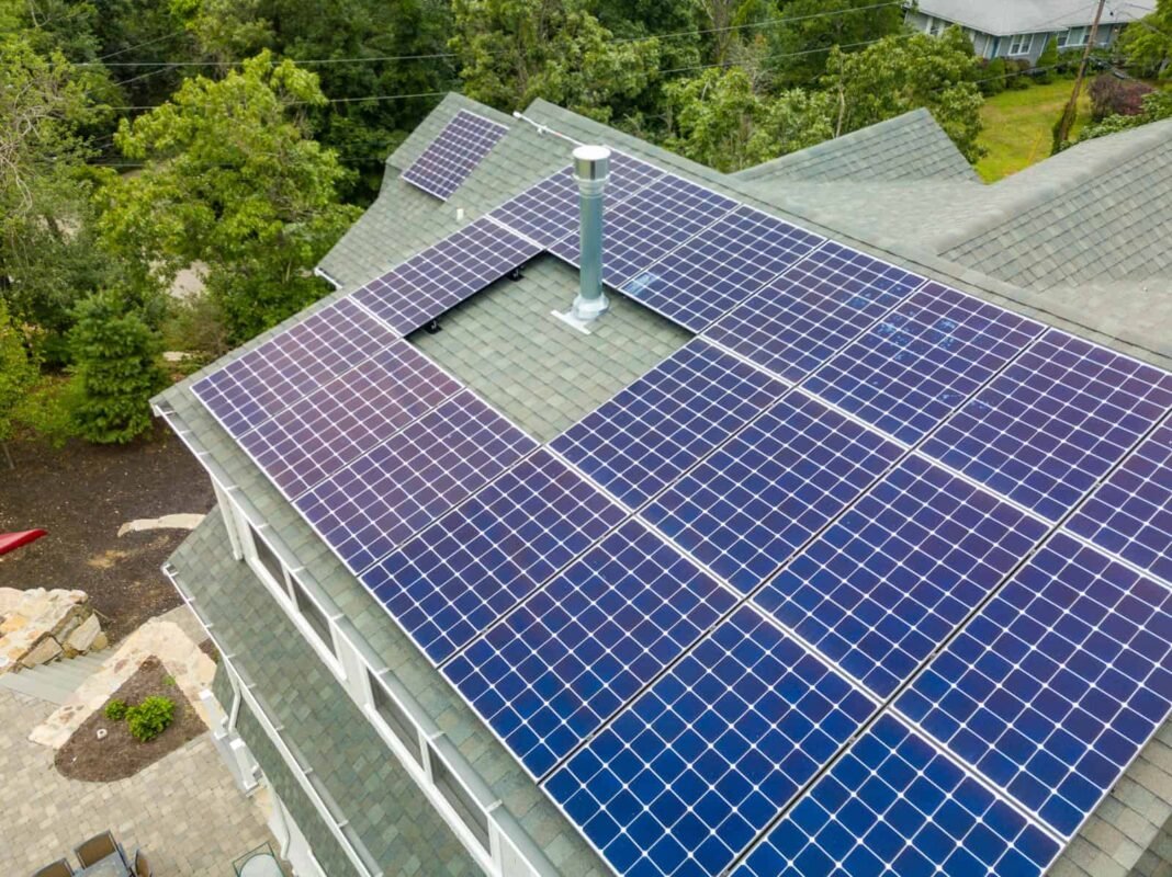
It allows you to gather important information from commercial and residential roofs to act and make decisions based on. Aerial views allow you to see the building or structure, detect leaks and imperfections, or simply understand the ventilation systems, HVAC or solar panels already installed on the roof. The combination of overhead photography and orthomosaic mapping can further enhance the information at hand. Look at the huge ceilings in the single picture. Collect rooftop measurements and incredible detail at resolutions up to 0.7 inches/px.
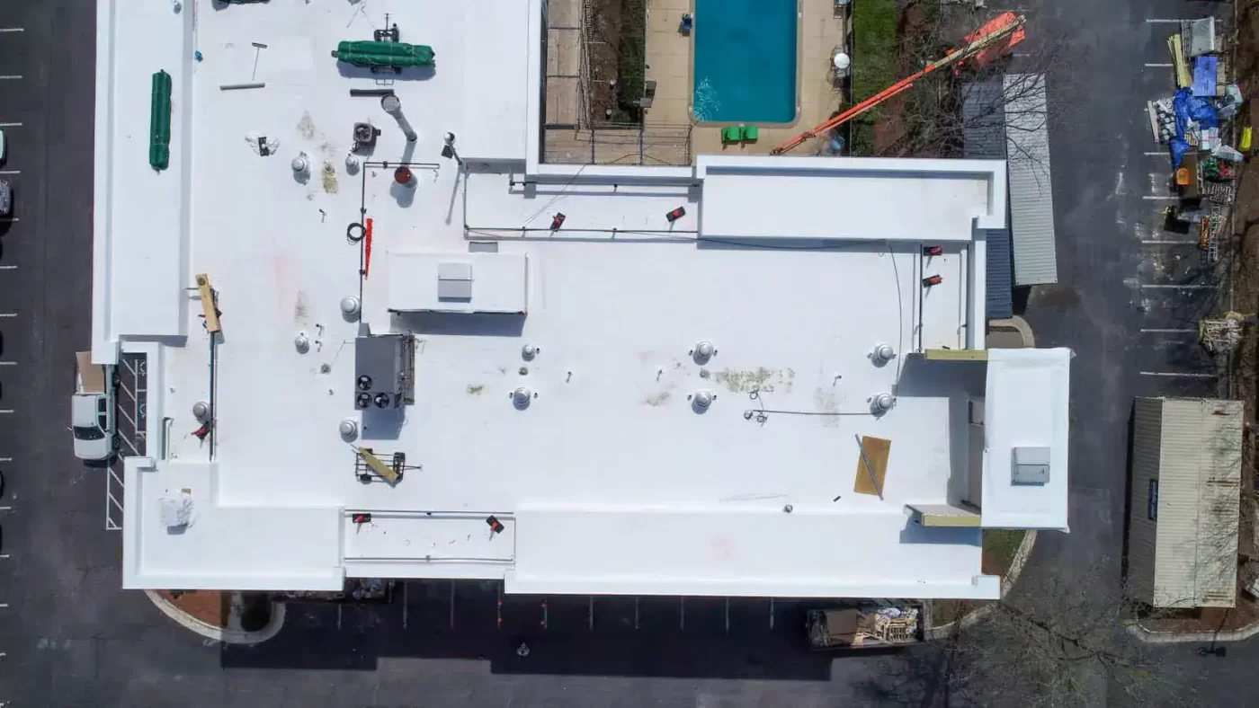
Aerial photography of your roof can help you make better, smarter and more informed decisions. Get practical information for roof repairs, remodeling projects or solar panel installations. Understanding roof conditions can help you create more accurate bids, project estimates, and more. High-resolution photos also allow you to communicate clearly with clients, investors or other stakeholders. Pomozte jim porozumět vaší práci, vašemu procesu a aktuálnímu stavu jejich projektu.
Buildings are deteriorating and sometimes side panel inspections are required in conjunction with roof inspections. Drones can easily fly into your area of interest and provide information rich detail.
With 4K video and high-resolution photos, drones are able to provide a detailed view of the current state of a building or side panel. Optical sensors on the drone also allow it to maintain a safe operating distance from the building.
Our editing team can further enhance photos to bring out details in shadows, increase contrast to highlight potential problem areas on a building, or meet your other editing needs.
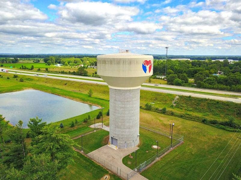
See your equipment and facilities from unprecedented angles with the power of aerial imagery. Get a panoramic view of your operations and infrastructure to understand them from entirely new perspectives
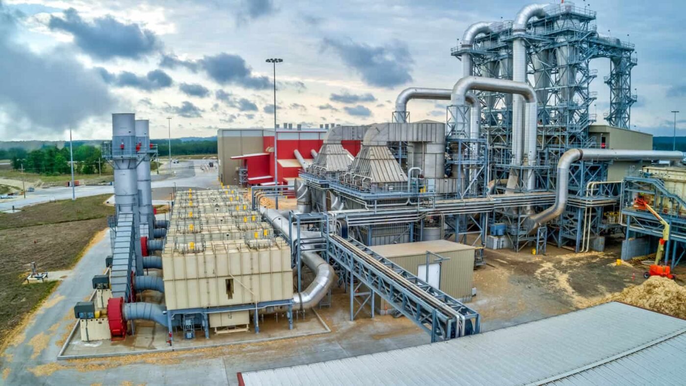
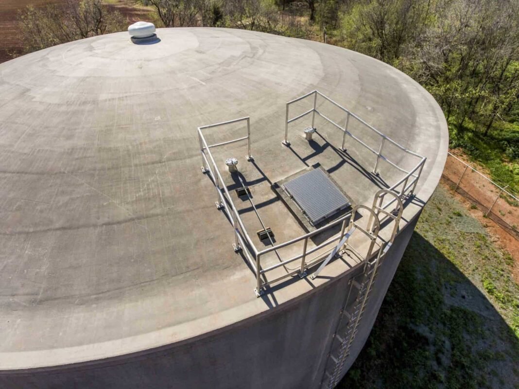
Aerial imaging can help you understand your facility, model your operations and provide valuable information. Drones allow safe manoeuvring in confined spaces. Check your tanks from different angles, sides and directions.
With a range of 7km and special transmission technology, drones allow you to operate and maneuver from a safe distance. View your structure from the ground and eliminate the risk of accidents by taking the best photos
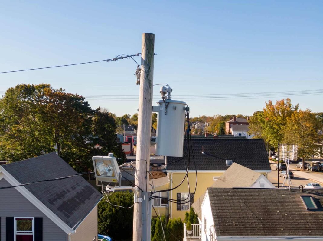
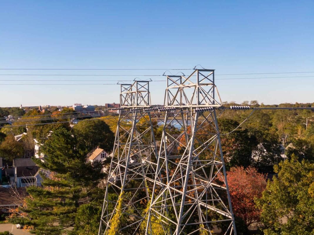
Mobile phone masts, radios and power lines can be high and dangerous to climb. Using drone photography allows you to fly around the tower and view it from all angles. Evaluate the security of the inspection before taking action.
Gather information before costly repairs Understand what equipment is broken or damaged to get better and more cost-effective repair solutions.
New zoom capabilities on the latest drone cameras allow you to get a very close look at your team. Capture better and more information than ever.
Longer flight times and greater operational ranges allow drones to quickly and efficiently survey multiple towers at once. Save time and mitigate the risk of workers climbing towers while working on equipment. Místo toho vyleťte s dronem během několika sekund, získejte detailní letecký pohled a snadno létajte mezi blízkými věžemi.
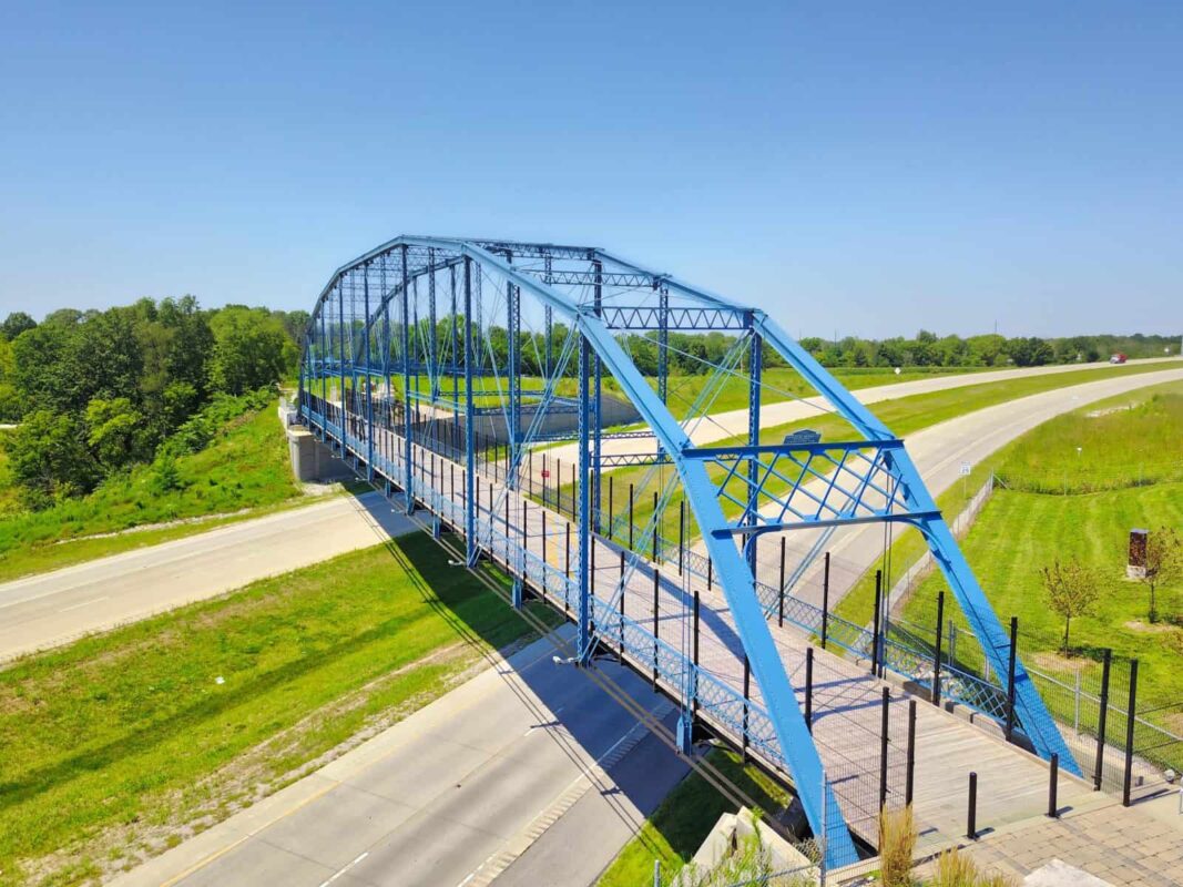
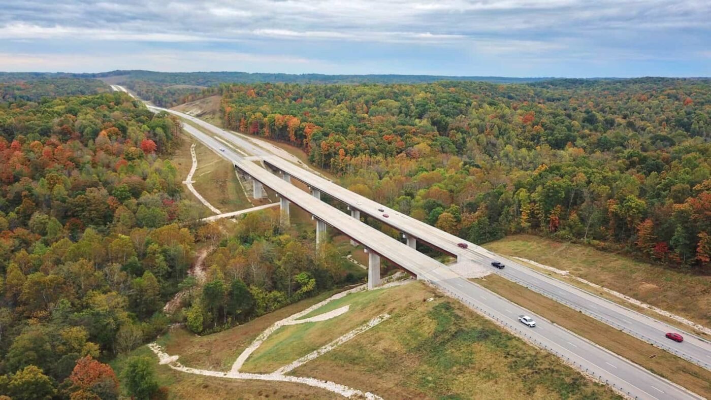
Building bridges has been one of the greatest engineering challenges and achievements. Whether you’re building suspension bridges, truss bridges, cable-stayed bridges, arch bridges, beam bridges or other ground transportation structures, aerial photography allows you to showcase your best work.
Capture attractive promotional photos and present your projects to clients, investors and others.
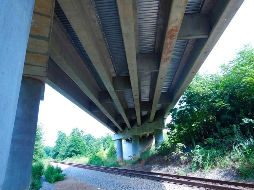
A drone bridge inspection allows you to see your bridge from all angles, even from below! Some drones have the ability to point their camera directly upwards, giving you valuable information from the bottom of your bridge. Použijte letecké snímky k vizuální kontrole vašeho mostu, zda na něm není rez, praskliny, strukturální slabá místa nebo jiné aspekty, které podle vás vyžadují pozornost.
Our high-resolution images give you the clarity and detail you need to make informed decisions.
With a maximum flight height of 120m and a maximum range of 7km, drones are ideal for showcasing the full scope of your project. Look at the roads leading to the bridge, understand the traffic flow and get a better picture of the topography of the land before construction begins.
Capture informative aerial images of solar panel installations.Check the condition, examine specific panels and get an overhead view of the installation.
Drone photography is also a great way to take pictures so you can pitch your solar panel solutions to customers, investors and others.
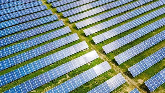
Get great views with high-altitude aerial imagery or get close-up photos and carefully check the condition of the panel. Drones are versatile tools for recording important information. You can easily monitor your panel installations from your location and only visit panels that require attention.
Our drone inspection services can be particularly useful for monitoring panels in hard-to-reach locations, such as on the rooftops of commercial buildings.
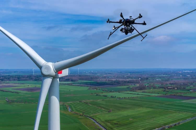
With a remote control range of 7 km and a maximum flight height of 120 m, drones are the perfect tools for gathering information on wind turbines.

Get aerial images of places or events in maximum quality. Our photographers fly top quality drones, capturing images of your project from virtually any angle.

After confirming the details and requirements of your project, we will send a pilot project for your specific location,We will schedule a flight whenever you need us.

We will share photos and videos with you. Within 24 hours of filming we’ll make the aerial imagery available for download.
Drones in the Film Industry: 7 Amazing Shots Drones have become an integral part[...]
*How to Choose a Drone for Photogrammetry Introduction to Photogrammetry What is Photogrammetry? Photogrammetry is[...]
*Drones and the Environment How Drones Help the Environment An Introduction to Drone Technology Drones,[...]
“`html Introduction Welcome to this article, where we will discuss drones and applications that can[...]

Photogrammetry Introduction Photogrammetry is a fascinating field that combines photography and precise measurement. This technique[...]